Mount Etna 2002 Eruption: What You See Today
Historical context and practical route reading in the 2002 eruption area.
Table of Contents
2002 eruption overview
The 2002–2003 eruption involved different phases. The INGV DANTE catalogue dates the northeastern phase from 27 October to 4 November 2002 and the southern phase from 27 October 2002 to 28 January 2003. The north-side lava affected Piano Provenzana’s tourist infrastructure. INGV chronology.
Reading the terrain today
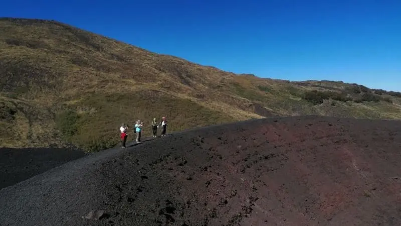
The landscape allows comparison of lava surfaces, crater forms and the return of vegetation on different substrates. The age and conditions of each surface influence how vegetation returns; older woodland and plants on young lava should be distinguished.
Safety and guided access
Weather, terrain, volcanic activity and current restrictions also affect routes below the summit. A guide helps interpret the landscape and manage the route but does not guarantee safety.
Sources
- INGV — Osservatorio Etneo — scientific documentation of the 2002 eruption and ongoing monitoring.
- Parco dell'Etna — trail access regulations and protected landscape management.
- UNESCO World Heritage — Mount Etna — natural heritage documentation.
- Collegio Regionale delle Guide Alpine e Vulcanologiche Siciliane — authorized guide register.
Key landforms to identify
In the 2002 sector, hikers can distinguish cone alignment, fracture orientation, and lava-surface textures that indicate cooling dynamics. Scoria-rich slopes, sharper crater rims, and blocky lava fields often coexist in short distances, making this area ideal for practical volcanology interpretation during guided walks.
Vegetation recovery is another field indicator. Pioneer species and patchy recolonization zones help estimate disturbance age and microclimate exposure. Reading these details improves route awareness and explains why some tracks remain unstable longer than others.
Route management and safety margins
Even in non-summit itineraries, wind, visibility, and local restrictions can alter usable sections on the same day. Guides adjust pacing, stop points, and return timing to keep the experience safe and informative. For visitors, the best approach is flexible expectations: conditions shape the exact line of travel, while core educational value remains high across the whole 2002 landscape.
Before You Book: Quick Planning Checklist
- Check updated weather and volcanic activity conditions for your travel dates.
- Confirm meeting point, start time, and transfer duration.
- Compare routes, practical details and availability, then use the booking calendar on your chosen tour page.
- Read local safety guidance before excursions.