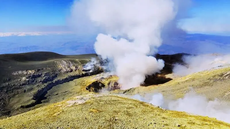
Etna Summit Craters Hike: Practical Volcanology Guide
What to check before a summit attempt: access, weather, gear, and effort.
Table of Contents
Summit route profile
Summit routes on Mount Etna reach ~3,400 m at the crater rim — Europe's tallest active volcano, as inscribed on the UNESCO World Heritage List. The terrain is steep volcanic ash and lava, with rapidly changing mountain conditions. Physical effort is significant, especially above 2,900 m where pace and wind tolerance matter most. Current access conditions are published by INGV — Osservatorio Etneo and enforced by Parco dell'Etna.
Requirements and equipment
Participants should have solid fitness, ankle-supporting boots with thick soles, layered clothing including a windproof shell, water, and sun protection. Certified guiding by an authorized Alpine and Volcanological Guide is required for the summit area under the ordinances in force and is critical for safe decision-making near active vents.
Conditions and route changes
Summit itineraries can be modified on the same day due to wind, visibility, volcanic activity, or civil protection restrictions. Always plan with flexible expectations and rely on final operational briefings from your guide team. The INGV volcanic communications page provides real-time alerts when conditions change.
Sources
- INGV — Osservatorio Etneo — volcanic monitoring and access condition bulletins for Etna summit routes.
- Parco dell'Etna — official access regulations and altitude limits for the summit zone.
- UNESCO World Heritage — Mount Etna — natural heritage documentation.
- Collegio Regionale delle Guide Alpine e Vulcanologiche Siciliane — register of authorized guides for summit access.
Effort management at altitude
Above 2800-3000 meters, pace control is more important than speed. Regular hydration, short recovery pauses, and wind protection materially improve performance and comfort. Summit-day outcomes depend on cumulative factors: previous-day fatigue, thermal range, terrain state, and route regulation updates. Prepare for variability rather than fixed expectations.
Equipment choice should prioritize stability and weather adaptability: layered clothing, shell protection, gloves, and reliable grip on volcanic terrain. Light but insufficient gear increases risk when conditions turn quickly.
Guide-led decision framework
Certified guides evaluate route feasibility through active observations, official constraints, and team condition. This can lead to itinerary adjustments without reducing the value of the day: geomorphology reading, active-zone interpretation, and high-altitude progression remain central even when lines are adapted. A successful summit experience is defined by safe execution and quality interpretation, not by a rigid altitude number.
Before You Book: Quick Planning Checklist
- Check updated weather and volcanic activity conditions for your travel dates.
- Confirm meeting point, start time, and transfer duration.
- Compare routes, practical details and availability, then use the booking calendar on your chosen tour page.
- Read local safety guidance before excursions.